I first saw the St. Stephen sub where it crossed highway 3 at Lawrence, 28.4 km from the intersection of highways 3 and 4.
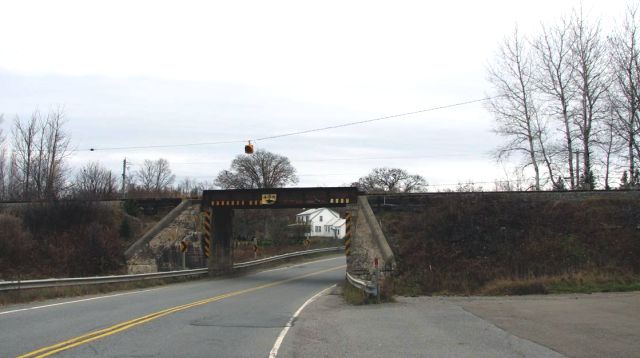
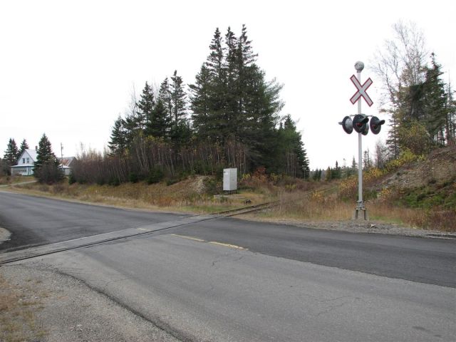
Shortly after going under the bridge, one can turn left to highway 127 to St. Andrews. You cross the St. Stephen sub at mile 15.33 at a level crossing with lights and crossbucks. There are pretty good sight lines in both directions.
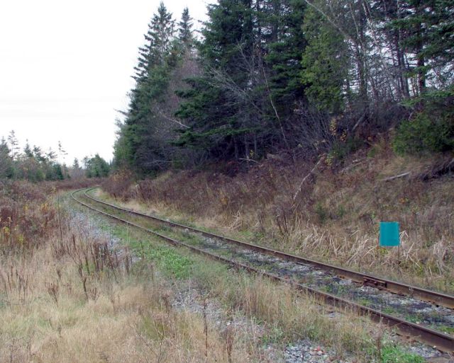
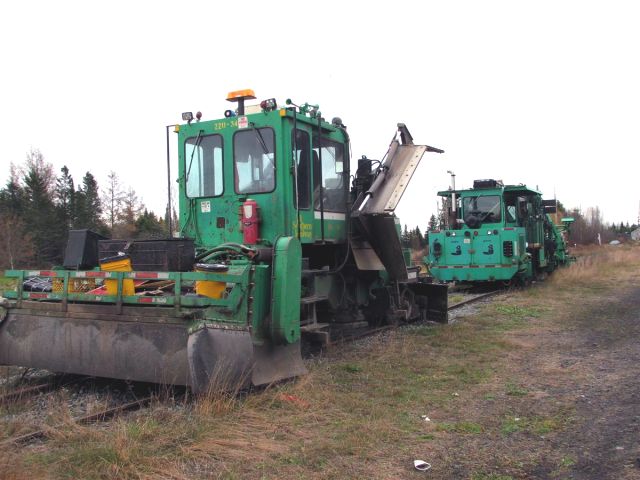
If you turn left on Watt Road shortly before this crossing, you come to what used to be Watt Junction at mile 14.9. The stub of the former St. Andrews subdivision is now used as a storage track for maintenance-of-way (MOW) equipment. On Saturday two pieces were stored there, ballast regulator 2211-34 and a Pandrol-Jackson 6700 Production and Switch Tamper.
There are just the two tracks there, a fuel tank, and some spare rails. Again, there are pretty good sight lines both ways.


Here is the area under discussion, through Google Maps.
After poking around there, I backtracked to highway 3 and continued on toward St. Stephen for a few kilometres before taking route 630 to St. Croix (14 minutes). From there I took highway 4 back to McAdam (5 minutes). Route 630 is in pretty good shape and one can sustain 80 or 90 km/hr on there with no trouble. If I were to chase the St. Stephen local from McAdam, I would definitely take the highway 4-route 630-highway 3 route to get to Watt Junction. I expect there would be no trouble beating the local there, as you would be travelling about the same distance but averaging about 60 km/hr (35 MPH), while the train is restricted to 25 MPH.
St. Stephen Sub timetable from 1988
Tags:
3 comments:
Interesting, for sure.
what of the intersection of the St Andrews line, where it crossed the Grand Southern Railway? Was it a diamond only or a junction?
Are there any traces of this location?
I'd appreciate any info you have. Thanks
Hi Clarence, the St. Andrews line crossed the Grand Southern Railway between Hewitt and Waweig on the St. Andrews line.
Hewitt was mile 23.7 and Waweig was mile 29.6. Between them was Brunswick (25.3) and Roix Road (27.8). I'm quite sure Brunswick was the crossing point. The 1935 CP public timetable shows Brunswick on both the Shore Line (former Grand Southern) and on the St. Andrews line.
Now... where is Brunswick? That I do not know. If I were to guess, it was in the center of this map (http://g.co/maps/qbubm). The line to St. Andrews is plain but there is only a hint of the former Grand Southern visible.
Thanks Steve, Brunswick, was the missing clue, who else but you would have the '35 timetable, haha.
Incidentally, a google search shows up "Brunswick Junction" in Charlotte CO, so that has to be the place.
http://archives.gnb.ca/exhibits/communities/Details.aspx?culture=en-CA&community=480
When the foliage dies down, I'm gonna try to hike that section of the old St Andrews line rail bed, south of Hewitt, if it still accessible, and see what I can see. Will be sure and send you a photo, if there is anything to see. Thanks again for your help. Cheers
Post a Comment